
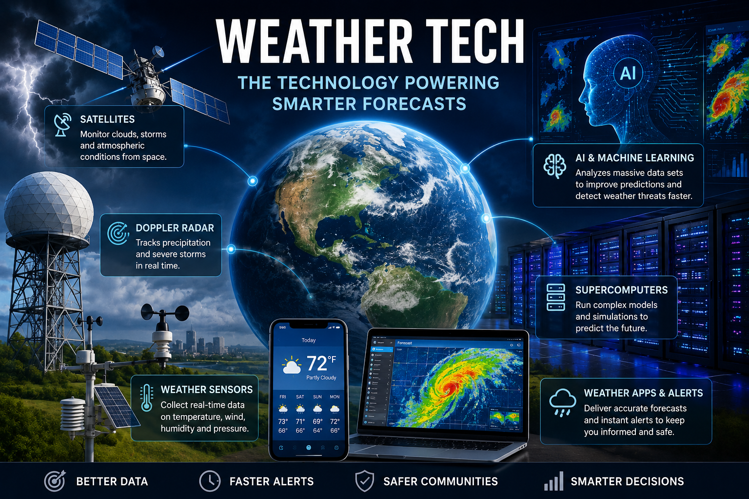
Weather tech covers the tools used to observe, analyze, predict, and communicate atmospheric conditions. Modern forecasting depends on far more than a thermometer or a weather station. Satellites watch large areas from orbit, radar tracks precipitation and storms, sensors collect measurements on the ground and at sea, while powerful computers process enormous amounts of data.
Artificial intelligence is becoming another important part of the process. NOAA and other weather organizations are testing AI and machine-learning systems to improve forecasting, data quality, and severe-weather prediction.
What Is weather tech?
weather tech is the broader technology ecosystem behind modern weather information. It includes hardware, software, scientific models, communication networks, and data-processing systems.
Some technologies collect observations directly. Others turn those observations into forecasts or alerts. A weather app on a smartphone is therefore only the visible end of a much larger system.
The basic process looks like this:
- Sensors and observing systems collect atmospheric data.
- Satellites and radar provide information over large areas.
- Computers combine observations with numerical weather models.
- Forecasters and automated systems analyze the results.
- Weather information reaches the public through websites, apps, broadcasts, and emergency alerts.
The National Weather Service uses radar products that provide precipitation information, storm-based alerts, and location-specific weather information.
Satellites Give Forecasters a View From Above
Satellites are among the most important pieces of modern weather infrastructure. They can monitor clouds, atmospheric conditions, oceans, land surfaces, and developing weather systems across areas that are difficult to observe from the ground.
Low Earth orbit satellites are particularly useful for collecting atmospheric, oceanic, and terrestrial measurements. NOAA says these observations contribute to forecasts involving severe weather and flooding.
Geostationary satellites provide another perspective by repeatedly observing large portions of the same region. This makes satellite imagery valuable for monitoring cloud development, hurricanes, thunderstorms, and other evolving systems.
The next generation of satellite technology is also being designed with forecasting needs in mind. NOAA reported in 2026 that simulations are being used to help design future satellite missions intended to improve weather forecasts.
Radar Tracks Storms in Real Time
Radar is especially valuable for short-term weather monitoring. Instead of waiting for conditions to be reported from individual locations, radar can reveal where precipitation is developing and how it is moving.
Modern radar systems can provide detailed information about rain, snow, and severe storms. National radar mosaics combine information from multiple radar stations into a broader view, giving forecasters and the public a more complete picture of active weather.
This is where weather tech becomes particularly useful for everyday decisions. If a storm is approaching a city, radar imagery can help people understand its current position and movement rather than relying only on a forecast issued several hours earlier.
Radar is also becoming a field for technological experimentation. NOAA research includes machine-learning approaches for improving radar data quality and analyzing severe-weather observations.
How AI Is Changing Weather Forecasting
Artificial intelligence is one of the fastest-developing areas in weather tech. Traditional numerical weather prediction relies on physical equations and enormous computing resources. AI models offer another approach by learning patterns from large collections of weather data.
That does not mean AI simply replaces traditional forecasting. Research organizations are exploring ways to combine data-driven methods with established numerical models and observations.
NOAA has been testing AI and machine-learning applications for areas including hurricane forecasting, satellite observations, and ensemble prediction. Its Project EAGLE, for example, is designed to test near-real-time AI models for global and limited-area ensemble forecasting.
The European Centre for Medium-Range Weather Forecasts is also developing AI-focused forecasting research and evaluation programs. Its AI Weather Quest platform compares the performance of different AI forecasting approaches.
💡 Pro Tip: When checking a forecast for severe weather, use current radar and official warnings alongside the regular hourly forecast. A forecast tells you what conditions are expected, while radar can show what is actually developing nearby.
Supercomputers Make Complex Forecasts Possible
Weather prediction requires huge amounts of computing power because the atmosphere is constantly changing and contains interactions across many scales.
Supercomputers process observations and run sophisticated Earth-system models that would be impractical on ordinary computers. The Destination Earth initiative notes that enhanced computing power is essential for running increasingly detailed Earth-system simulations.
Higher-resolution models can provide more detailed information about local conditions. That can be particularly useful for hazards such as intense rainfall, flooding, heat, and severe storms, where conditions can change considerably across relatively short distances.
The challenge is not simply having a faster computer. Forecasting systems also need high-quality observations, reliable models, efficient software, and ways to communicate uncertainty clearly.
Weather Sensors Are Getting More Connected
Ground-based sensors remain essential even in an age dominated by satellites and AI. Weather stations measure variables such as temperature, pressure, humidity, wind, and precipitation.
Research into observing technology focuses on improving the detection and forecasting of hazardous weather. NOAA’s Observations Program works with government, academic, and private-sector partners to develop and move new observing technologies into operational use.
Connected sensors can also make weather information more useful at a local level. A dense network of observations can reveal differences between nearby areas that might not be obvious from a single station.
This matters for transportation, agriculture, aviation, emergency management, energy systems, and outdoor planning.
The Benefits and Limits of Modern Weather Technology
The biggest advantage of weather tech is the ability to combine many different types of information. A forecast can draw on satellite observations, radar, surface measurements, ocean data, atmospheric models, and increasingly sophisticated computing techniques.
| Technology | Main Role | Where It Helps Most |
|---|---|---|
| Weather satellites | Large-area observation | Hurricanes, clouds, atmospheric monitoring |
| Weather radar | Tracking precipitation and storms | Severe weather and short-term decisions |
| Ground sensors | Local measurements | Temperature, wind, rainfall, pressure |
| Supercomputers | Running complex models | Numerical weather prediction |
| AI and machine learning | Pattern analysis and forecasting | Nowcasting, data processing, model development |
| Weather apps | Delivering information | Everyday planning and alerts |
There are still limits. Forecast uncertainty cannot be eliminated because the atmosphere is complex and observations are never perfect. AI systems also depend on the quality and coverage of the data used to develop and evaluate them.
For this reason, better technology should be viewed as a way to improve forecasting rather than a guarantee that every prediction will be correct.
📌 Key Takeaway
weather tech has evolved into a connected system involving satellites, radar, sensors, numerical models, supercomputers, and AI. Each component has a different job, and the strongest forecasting systems combine them rather than depending on one technology. For the public, the result is more detailed observations, faster warnings, and increasingly sophisticated forecasts.
Frequently Asked Questions
What does weather tech mean?
weather tech refers to technologies used to observe, analyze, forecast, and communicate weather information. It includes satellites, radar, weather stations, sensors, computer models, supercomputers, artificial intelligence, and forecasting software. Consumer weather apps are one part of this much larger technology ecosystem.
How does AI improve weather forecasting?
AI can identify patterns in large weather datasets and generate predictions efficiently. Researchers are investigating its use for tasks such as precipitation estimation, severe-weather nowcasting, satellite data processing, and broader forecasting. AI is increasingly being studied alongside traditional numerical weather prediction rather than simply treated as a replacement for it.
Why are weather satellites important?
Satellites provide observations across huge areas, including regions with relatively few ground-based instruments. They can monitor clouds, atmospheric conditions, oceans, and developing storms. Low Earth orbit satellites provide valuable atmospheric and surface measurements that can contribute to forecasting severe weather and flooding.
Is radar more accurate than a weather forecast?
Radar and forecasts serve different purposes. Radar shows observed precipitation and storm activity, making it valuable for understanding what is happening now. A forecast estimates future conditions using observations and models. For short-term decisions during changing weather, looking at both can provide more useful context than relying on either one alone.
Will AI replace meteorologists?
There is no reason to assume that AI will eliminate the need for meteorologists. Forecasting involves interpreting observations, understanding uncertainty, communicating risks, and making decisions in complex situations. Current research focuses heavily on using AI as another forecasting and data-processing tool within the broader weather enterprise.
Weather forecasting is becoming increasingly dependent on the quality of the technology behind it. Satellites expand the observing network, radar provides detailed storm information, sensors fill local gaps, and supercomputers process complex models. AI adds another layer of capability that researchers are still actively evaluating.
For anyone following weather tech, the most interesting development is not one single device or algorithm. It is the way these technologies are being connected into faster and more detailed forecasting systems. That combination could make weather information increasingly useful for everyday planning and, more importantly, for preparing for dangerous conditions.
